Information about the city map of Fürth in the corridor 1.OG
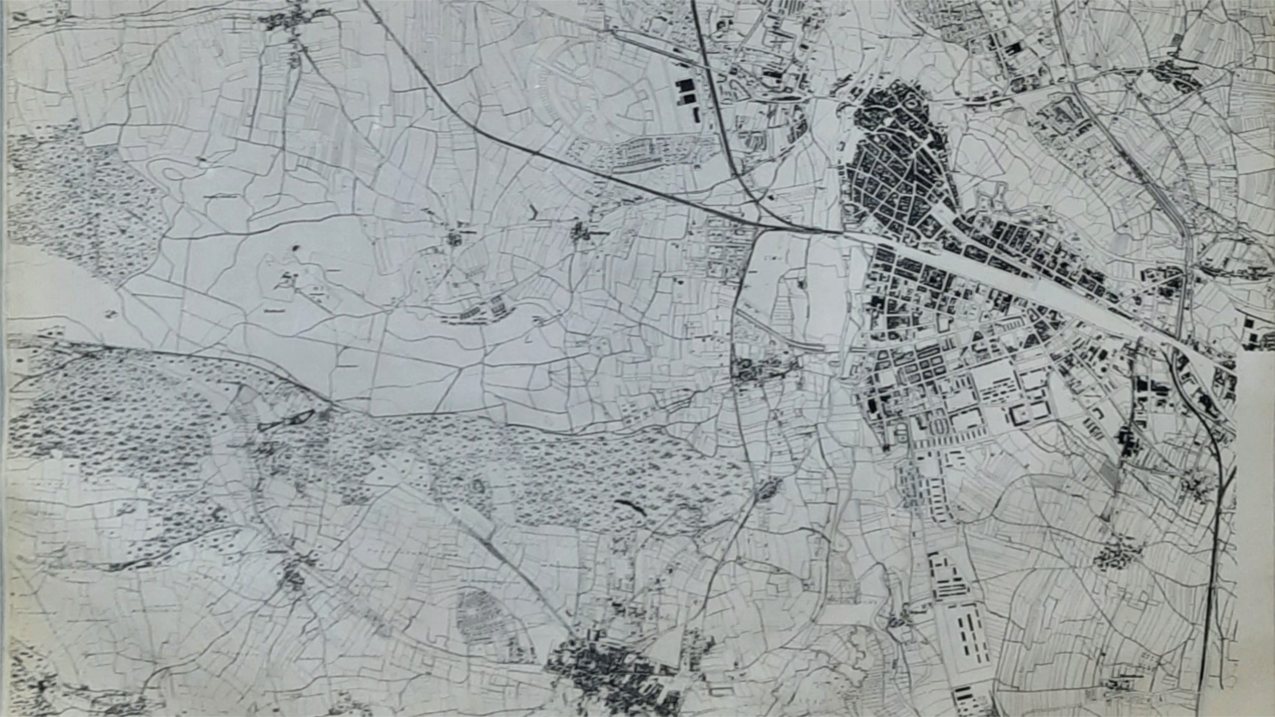
The print shown is an excerpt from a teaching aid of the Poppenreuth elementary school. The former principal, Mr. Gerhard Fuchs, saved the city map of Fürth printed in 1952 from destruction. Thankfully, Mr. Fuchs made the teaching material available to me for some time. My research in the Fürth city archives to find the map in digital form was unfortunately unsuccessful. So I have digitized a section that is interesting for the Hotel Grüne Elster. The legs of our logo Green Magpie stand exactly on the former designated property area. If you look at the track running diagonally up and down, this is the former rail facility of the Ludwig-South-North Railway. So our hotel is exactly on this route. Therefore, during the construction work, special regulations had to be followed during excavation. Note on the print also the “Old Canal” with the Poppenreuther harbor drawn in. The Old Canal had to make way for the construction of the present Frankenschnellweg after 1950. At this point you now have the freeway on and off ramps from the Poppenreuther Bridge to Erlangen and Nuremberg. In room 2 there is another representation of “The Old Canal”.